Maps for Thanet District Councils Shop & Eat Local this Christmas campaign.

To help you shop and eat local this Christmas you can view a series of Maps covering Shops, Restaurants, Cafes and Bars in Thanet as a whole or go really local and view them for a specific Town.
Click on the following links to go directly to the Google Maps :-
Town Maps
- SHOP & EAT LOCAL in Birchington (includes St Nicholas at Wade, Sarre, Acol & Monkton)
- SHOP & EAT LOCAL in Broadstairs (includes St Peters)
- SHOP & EAT LOCAL in Margate
- SHOP & EAT LOCAL in Ramsgate (includes Minster)
- SHOP & EAT LOCAL in Westgate-on-sea
Thanet Map
The Maps can also be viewed below :-

Birchington
Broadstairs
Margate
Ramsgate
Westgate on Sea
Thanet
How to use Maps
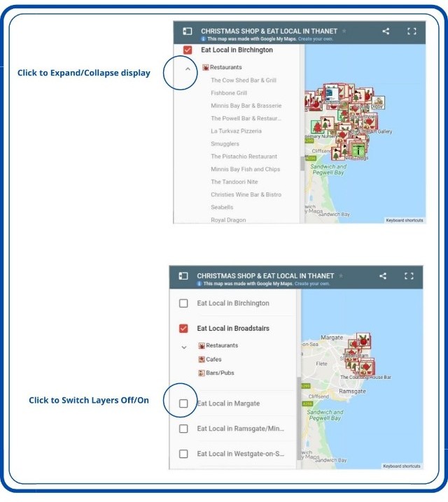
The Maps zoom facility enables you to select to focus on a specific area of the Map. You can also use the Side Menu option (click on the Side Menu icon in the top left hand corner of the Map) to not only view an index of the Maps contents, but also to switch off/on the layers being displayed.

Using Maps on Websites/Blogs
Maps can be embedded in Websites/Blog posts.
Click here to learn more about No Expert Mapping.